GEM Programme
Throughout the Arctic there is substantial concern about climate change and the effects upon the arctic ecosystem, which is the basis for most of the people and societies in the arctic. The arctic council has initiated multiple initiatives to monitor and investigate the environmental effects in the Arctic. Greenland Ecosystem Monitoring (GEM) is one of the contributions from the Kingdom of Denmark, including Greenland.
Greenland Ecosystem Monitoring is an integrated monitoring and long-term research programme on ecosystems and climate change effects and feedbacks in the Arctic. Since 1994 the programme has established a coherent and integrated understanding of the functioning of ecosystems in a highly variable climate, which is based upon a comprehensive, long-term inter-disciplinary data collection carried out by Danish and Greenlandic monitoring and research institutions, primarily at three main field stations: Zackenberg in high Arctic Northeast Greenland, Nuuk in low Arctic West Greenland and Disko in low/high Arctic West Greenland.
More information about the GEM science programme and the GEM database can be found through g-e-m.dk
GEM consist of sub-programmes (see below) and a number of strategic cross cutting initiatives that also includes collaboration with other complimentary operational monitoring and research activities.
ClimateBasis
The ClimateBasis programme monitors climate and hydrology in Zackenberg and Kobbefjord and is run by Asiaq - Greenland Survey. The collected data build base-line information on climate variability and trends for all the other sub-programmes within GEM and serve as a trustworthy foundation for adaptation strategies for the Greenlandic society. The stations are embedded in Asiaq’s extensive climate and hydrology monitoring network. Furthermore, the run-off data is delivered to the World Hydrological Cycle Observing System (WHYCOS) and the Global Runoff Data Centre (GRDC) networks.
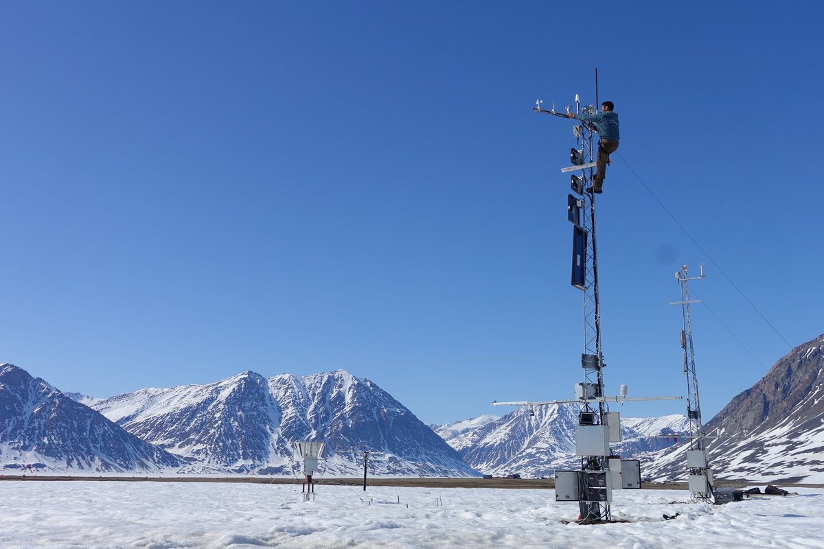
Atmospheric parameters are collected redundantly at each location on two separated masts with individual energy supply in order to be able to treat data gaps and sensor biases consistently. Hydrometric parameters are monitored on various automated stations. A challenging focus is put on the establishment of reliable stage-discharge relations, whose temporal stability depends on the river bed. At the river Zackenberg for instance, repeated glacier outburst floods require an updated stage-discharge relation every year, where the related field work is performed together with the GeoBasis sub-programme. Glaciological measurements (surface mass and energy balance, ice flow) complement the monitoring activities in Kobbefjord on a small mountain glacier and two fully equipped energy balance stations (one in Upernaviarsuk in South Greenland, one in Qaanaq in North Greenland) have been added to the sub-programme after 2012.
ClimateBasis Zackenberg Manual
Contact person: Kirsty Langley <kal@asiaq.gl>
Further information about Asiaq
GeoBasis
The GeoBasis monitoring programme focuses on selected abiotic characteristics in order to describe the state of Greenlandic terrestrial environments and their potential feedback effects in a changing climate. Monitored plot data is up-scaled to a landscape level and is used to improve ecosystem models to be able to quantify these feedback mechanisms. The GeoBasis programme provides an active response to recommendations in international assessments such as ACIA and SWIPA; and is continuously being adapted based on AMAP and other international founded recommendations. Furthermore, the GeoBasis programme is directly involved in several international networks and research projects (e.g. the Circumpolar Active Layer Monitoring (CALM) programme, the Nordic Centre of Excellence DEFROST, the Danish Centre of Excellence CENPERM, the EU-projects PAGE21 and INTERACT, and the Arctic Research Centre at Aarhus University). The GeoBasis programme is divided into a number of sub-groups, including:
- Snow properties; spatial and temporal variation in snow cover, depth and density.
- Soil properties; spatially distributed monitoring of key soil parameters such as temperature, moisture, chemistry and seasonal progression of active layer depth.
- Meteorology; essential meteorological variables across various surface types and elevations and the coast/inland gradient.
- Flux monitoring; plot and landscape scale flux monitoring of CO2, CH4, H2O and energy in wet and dry ecosystems.
- Hydrology; seasonal variation in river water discharge, chemistry and suspended sediment.
- Geomorphology; shorelines dynamics, coastal cliff recession and cross-shore river profiles.
GeoBasis Zackenberg Manual (ver. April 2019, 186 pp. - PDF 6.1 MB).
Contact info: Mikhail Mastepanov <mikhail.mastepanov@ecos.au.dk>
Further information about Department of Ecoscience, Aarhus University
GlacioBasis
Since 2008, the GlacioBasis programme has been monitoring the glacier surface mass balance at the A.P. Olsen Ice Cap and its response to climate forcing. Greenland’s glaciers and Ice Caps are losing mass at a rate more than double of the Ice Sheet when adjusted for size, accounting for 14-20 % of the total sea level rise contribution from Greenland. As the glaciological component of a core WMO GCW CryoNet site and a contributor to the GTN-G through WGMS, the GlacioBasis datasets complement the ongoing monitoring based at Zackenberg, enable process-based understanding of physical processes driven by glacier melt water run-off in the downstream terrestrial and marine ecosystems, and can inform regional and global assessments under AMAP and IPCC.
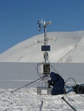
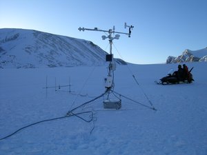
Photo: Charlotte Sigsgaard. Photo: Michele Citterio
GlacioBasis operates the year-round automatic monitoring of A.P. Olsen Ice Cap near-surface weather at three stations, a network of ablation stakes covering the entire altitude range, and geophysical survey campaigns on the ground (radar snow depth) and airborne (surface elevation from lidar, ice thickness from radar). GlacioBasis data collection is adaptively updated to support research in processes emerging as key sources of nonlinearity in the cryosphere, including melt water retention and albedo feedbacks. As a representative Northeast Greenland Ice Cap, A.P. Olsen observations delivered by GlacioBasis are available to the national and international remote sensing and climate modelling communities for calibration, validation and upscaling purposes.
Photo: Charlotte Sigsgaard.
Contact: Signe Hillerup Larsen <shl@geus.dk>
Further information about GEUS
BioBasis
The BioBasis programme monitors the dynamics of organisms and biological processes in the terrestrial and limnic ecosystems at Zackenberg and Nuuk. The BioBasis programme plays a central role in the development and implementation of the Circumpolar Biodiversity Monitoring Programme (CBMP) http://www.caff.is/monitoring across the Arctic.
A large variety of species and processes across plant and animal populations and their interactions are monitored within the BioBasis programme, thereby documenting the inter-annual variation and resilience as well as the long-term trends. Emphasis is on biodiversity, abundance, reproduction and phenology as important components in the structure and functioning of the arctic ecosystems:
- Monitoring of flora (lichens, mosses and vascular) including species diversity, abundance and phenology, herbivory, and greening patterns.
- Monitoring of arthropod biodiversity and emergence phenology.
- Monitoring of birds including species diversity, abundance, and breeding phenology.
- Monitoring of mammals including species diversity, abundance and reproduction.
- Monitoring of freshwater biotic and abiotic dynamics, including biodiversity and phenology of phyto- and zoo-plankton, and abundance of fish as well as water chemistry.
BioBasis Zackenberg Manual 22nd edition, 2019 (PDF)
Contact: Niels Martin Schmidt, nms@ecos.au.dk
Further information about Department of Ecoscience, Aarhus University
MarineBasis
The MarineBasis programme collects physical, chemical and biological data from the Greenland coastal zone. Work is focused in two fjord systems (Godthåbsfjord and Young Sund) both influenced by glaciers connected to the Greenland Ice Sheet.
The programme delivers base-line data that enables identification of long-term trends in key parameters such as sea ice coverage, ocean temperature, salinity and pH, nutrient dynamics, primary production and marine biodiversity. Data from the program are integrated in several work groups under the Arctic Council such as CBMP, AMAP and CAFF.
The MarineBasis programme leads and collaborates actively in research projects that increase knowledge of how climate impacts the marine ecosystems in Greenland. A specific focus has been comparative studies along large scale gradients in Greenland complementing the time series from the focus sites.
MarineBasis Zackenberg Manual (PDF 1.8 MB)
Contact: Mie S. Winding <miwi@natur.gl> or Mikael C. Sejr mse@ecos.au.dk
Further information about Greenland Institute of Natural Resources, Department of Ecoscience, Aarhus University and Arctic Research Centre, Aarhus University
Remote Sensing and Ecosystem Modeling
The purpose of the Remote Sensing and Ecosystem Modeling sub-programme is to create products and frameworks aligned with the three science themes from the GEM 2022-2026 strategy, for use by national/international stakeholders and researchers. The data from the Remote Sensing and Ecosystem Modeling sub-programme will be made freely available to users, and we will put an effort in upgrading the GEM database to include these datasets with oftentimes high storage space requirements.
- Product 1: Satellite-based cloud cover
- Product 2: Downscaled 2m monthly air temperature grids
- Product 3: Skin and sea surface temperature from satellite
- Product 4: Snow depth (snow water equivalent) model
- Product 5: High resolution snow cover (over land and sea ice) and albedo
- Product 6: Carbon, water, energy cycles modeling
- Product 7: Enhanced high resolution land-cover classification
- Product 8: Topographic wetness index (TWI)
- Product 9: Spectral and structural canopy diversity
- Product 10: Marine chlrorophyll-a
- Product 11: Coastal underwater light
- Operational product 12: Satellite-based NDVI
- Operational product 13: Satellite-based Land surface temperatures
Contact person: Efrén López-Blanco <elb@ecos.au.dk> or Andreas Westergard Nielsen awn@ign.ku.dk