GlacioBasis programme
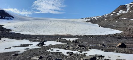
Glaciers are important to ecosystems, acting as natural water reservoirs that release meltwater on seasonal to multi-year timescales. This delayed runoff supports both terrestrial and marine life, independent of rainfall. On a global scale, glacier ice stores water in cold periods and releases it during warmer phases, significantly influencing sea levels. Unlike the large ice sheets of Greenland and Antarctica, glaciers and ice caps respond more rapidly to climate change. In fact, global glacier melt contributes about 18% more than the Greenland ice sheet and over twice as much as the Antarctic ice sheet.
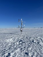
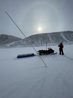
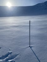
GlacioBasis is the glaciological component of the Greenland Ecosystem Monitoring (GEM) programme. It began in 2008 at Zackenberg and has since expanded to Nuuk (2014) and Disko (2016). Year-round monitoring combines automatic stations with seasonal field campaigns. Data is submitted to both the GEM database and the World Glacier Monitoring Service (wgms.ch). The automatic stations continuously measure key variables of the glacier surface mass balance: snow accumulation, melting (ablation), and related climate variables. Mass balance is observed using ablation stake networks, while snow cover is observed through time-lapse cameras, ground-based radar, and drone surveys.
Monitored parameters:
- Surface mass balance
- Continuous observations of:
- mass balance components:
- ice ablation
- snow depth
- Surface energy balance components:
- Temperature
- Humidity
- Radiation
- Pressure
- Wind speed
- Radiation: incoming and outgoing shortwave and longwave
- mass balance components:
- Annual snow depth surveys from probes, drones and radar
- Surface elevation change (UAV)
- Time lapse imagery